What the Karhunkierros trail actually is
Karhunkierros translates as “the Bear’s Trail”, and it’s the best-known long-distance hiking route in Finland: roughly 82km running between Hautajärvi in the south and the ski resort of Ruka in the north, cutting through Oulanka National Park for most of its length. It follows the Oulanka river valley, crossing gorges on suspension bridges, passing waterfalls and rapids, and climbing over ridges of pine forest and open fell.
It sits in the Ruka and Kuusamo area, about 190–200km from Rovaniemi — this page is about the trail itself: the route, the stages, the free huts along the way, and who it actually suits. For the park’s wider landscape, wildlife and history, see the separate Oulanka National Park guide; for the rapids at the trail’s most-visited point, see the Kiutaköngäs page.
The single most important thing to understand before planning anything: the full Karhunkierros is a four- to five-day backpacking trip, not a day trip. A large share of visitors who come out this way never intend to walk all 82km — they park near Juuma or Kiutaköngäs and walk one short, well-marked loop of a few kilometres, see the rapids and a suspension bridge, and turn back within two or three hours.
That’s a perfectly good outing. What causes disappointment is arriving expecting to “do the Karhunkierros” in an afternoon and finding out, at the trailhead noticeboard, that the trail you pictured is several days long. Decide which of these two trips you’re actually taking before you set off, because the gear, the time and the logistics are completely different.
The route: south to north
Most people walk from south to north, starting at the Hautajärvi visitor centre and finishing in Ruka, mainly because trailhead transport (buses and taxis) is easier to arrange in that direction and because the northern half has the trail’s biggest single climbs, which feel better tackled once you’re a couple of days in. The trail can be walked in either direction, and shorter sections can be picked up from several midpoint access roads, which is exactly how most day and half-day visitors use it.
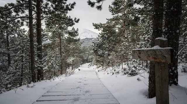
The terrain is best described as accumulating rather than steep: no single climb is severe, but the trail rarely runs flat for long, crossing a steady sequence of ridges, riverbanks, boardwalks over wet ground, and rocky, root-crossed sections that slow your pace more than the distance numbers suggest. Add the suspension bridges — several of them, swaying over the Oulanka gorge — and a full day’s walking on Karhunkierros takes noticeably longer than the same distance on a flat forest path.
Trail markers use the recognised Finnish national park orange-tipped poles and painted blazes, and the route is well maintained and hard to lose, but it is genuinely remote for stretches: mobile signal drops out in the deeper valleys, and on quieter weekdays outside July you can walk for hours without meeting anyone.
Rough stages for a multi-day hike
Distances vary a little by source and by exactly which side trails you take, but this is the shape most four- to five-day itineraries follow:
| Stage | Approx. distance | Typical highlights |
|---|---|---|
| Hautajärvi to Savilampi | ~12km | Visitor centre start, first river crossings |
| Savilampi to Jussinkämppä | ~10km | Forest ridges, quieter stretch |
| Jussinkämppä to Juuma (Myllykoski) | ~15km | Suspension bridges, Myllykoski rapids |
| Juuma to Kiutaköngäs | ~7km | The trail’s most visited section — see the Kiutaköngäs page |
| Kiutaköngäs to Sallivaara | ~10km | Quieter northern section begins |
| Sallivaara to Ruka (Basaari) | ~28km | Long final push, often split over two days |
Treat these as planning ranges, not survey measurements — check the current Metsähallitus (Finnish national parks authority) trail map before you go, since access points and side-trail options change slightly year to year. Most hikers split that last long stretch into two shorter days rather than walking it in one go, which is how a “four-day” hike often becomes five in practice.
Free wilderness huts and lean-tos (laavu)
One of the things that makes Karhunkierros accessible on a tight budget is the string of free overnight shelters along the route, maintained by Metsähallitus. There are two main types:
- Open wilderness huts (avotupa) — basic timber cabins with bunks or sleeping platforms, a wood stove, and sometimes a stored supply of firewood. They’re unlocked, free, and run on a first-come, first-served basis: nobody can reserve a spot, and on a busy July weekend a hut can fill up, in which case you pitch a tent nearby instead.
- Lean-to shelters (laavu) — open-fronted, three-sided shelters with a fire pit outside, meant for a stop or an overnight in a sleeping bag rather than a full hut stay.
Both are free to use, but they come with real responsibilities: you carry out everything you carry in, you leave firewood for the next hiker if you use the stored supply, and you don’t expect mattresses, cooking gas or drinking water on tap — most huts sit near a stream or lake where you filter or boil your own. Because nothing can be booked, the sensible approach for a first-time hike is to carry a lightweight tent as backup even if you plan to sleep in huts. This system exists under Finland’s right to roam, or everyman’s right, and using it well is part of hiking here.
How hard is it, really
Karhunkierros isn’t a technical trail — there’s no scrambling, no exposed climbing, no need for ropes or crampons in summer conditions. What makes it a genuine backpacking trip rather than a casual walk is the combination of distance, terrain and self-sufficiency:
- Distance and duration. 82km over four to five days means averaging 15–20km on your longer days, on uneven ground, carrying camping and food supplies.
- Terrain underfoot. Roots, rocks, boardwalks and river crossings slow you down more than the kilometre count implies — plan your daily distance around hours walked, not just distance.
- Suspension bridges. Several long, swaying wire bridges cross the Oulanka gorge. They’re safe and well maintained, but if you’re uneasy with height and movement underfoot, know that in advance.
- Self-sufficiency. You carry your own food for the whole trip (there are no shops or restaurants on the trail itself), your own sleeping gear as backup to the huts, and a means of purifying water.
- Weather. Lapland weather changes fast even in summer — rain, wind and single-figure overnight temperatures are normal in a Finnish June or September, whatever the forecast said in the morning.
None of that makes it an extreme hike. Reasonably fit walkers with basic backpacking experience — people who’ve done a multi-day hut-to-hut trip elsewhere — manage it comfortably. It’s a poor choice for a first-ever multi-day hike with no backcountry experience at all, and a poor choice for young children on the full route (the short loops near Juuma or Kiutaköngäs work fine for families instead — see kid-friendly activities around Rovaniemi for other ideas better suited to that age group).
When the trail is actually open
| Period | Trail condition |
|---|---|
| June | Snow largely gone, rivers can still run high with meltwater, long daylight |
| July–August | Peak season, driest and busiest, huts fill up on weekends |
| September–early October | Ruska colour, cooler, quieter, still reliably walkable |
| Mid-October–May | Not recommended: ice, snow, unbridged meltwater crossings and short daylight make the full trail unsafe without winter skills and gear |
June to October is the walkable window, and even within it, early June can still have patches of snow and swollen streams from the spring melt, while late October can bring the first hard frost and ice on boardwalks. If you’re planning a through-hike, July to mid-September is the safest bet for predictable conditions; September specifically rewards you with the ruska colours and thinner crowds, at the cost of shorter days and a real chance of cold nights. Outside that window, this becomes a winter route for equipped, experienced parties only — not a normal tourist hike, and not something to attempt on the strength of this page.
Getting to the trailheads
Both ends of the trail sit well outside Rovaniemi, and neither is served by frequent public transport, so most hikers arrive by rented car or organise a taxi transfer:
- Hautajärvi (south end): roughly 200km from Rovaniemi by road, around 2h45–3h driving via Kuusamo. This is the quieter, less developed trailhead.
- Ruka (north end): roughly 190km from Rovaniemi, about 2h30 driving. Ruka has hotels, restaurants and shops, making it the more comfortable end to start or finish at.
Because the trail runs point to point rather than in a loop, a through-hike needs either two cars (one left at each end), a pre-booked taxi transfer between trailheads, or a hiking company’s shuttle service — arrange this before you set off, since taxi availability in a sparsely populated area is limited. If you’re driving yourself for winter or shoulder-season dates, check winter tyre requirements and reindeer on the road before the drive out — both apply on the road to Kuusamo as much as anywhere else in the region.
If you don’t want to manage transfers and self-sufficiency at all, some things to do near Ruka and Kuusamo operators run guided day walks on the short Kiutaköngäs loop with transport included — a reasonable option if you want to see the trail’s best-known stretch without committing to the logistics of the full route.
What to pack
The same three-layer system that applies across Lapland applies here, with backpacking additions: a rain shell that actually holds up (Lapland rain isn’t gentle), broken-in hiking boots rather than trainers, a sleeping bag rated for near-freezing nights even in summer, a lightweight tent as hut backup, a stove and enough food for every day on the trail (there is nowhere to buy more), a map or the Metsähallitus trail app, and a means of purifying stream water. Midges and mosquitoes can be genuinely unpleasant in June and July near the river — pack repellent and a head net if you’re sensitive to them.
Combining it with the rest of a Lapland trip
Karhunkierros sits far enough from Rovaniemi, and far enough into the warmer months, that it rarely combines neatly with the winter activities most visitors come to the region for — it’s a different season and a different kind of trip. If your visit straddles the shoulder season, though, some hikers base a night or two in Ruka around the walk and add on an evening out under the sky once the nights start drawing in again in early autumn — an aurora-watching evening with a campfire and hot drinks works well as a low-effort add-on once your legs have had enough walking for the day.
If you’re building a longer, separate winter trip around Rovaniemi instead, the closest equivalent to multi-day hiking in that season is guided cross-country ski trekking under the northern lights, which covers similar wilderness terrain on skis rather than on foot. Travellers routing a wider Lapland itinerary through Levi as well sometimes tack on a private aurora hunt out of Levi before or after the Kuusamo leg — worth knowing about if you’re stringing several regions together rather than basing everything in Rovaniemi.
For planning a wider trip that includes this trail, see how many days to allow in Rovaniemi and a general Rovaniemi trip budget — Karhunkierros itself is one of the cheaper things you can do in the region, since huts are free and the main cost is food and the drive out.
Karhunkierros trail: frequently asked questions
Can I walk the whole Karhunkierros trail in one day?
No. At roughly 82km over uneven, hilly terrain, the full trail takes most hikers four to five days. What can be done in a single day, or even a few hours, is one of the short, well-marked loops near Juuma or Kiutaköngäs — that’s what most day visitors actually walk.
Do I need to book the wilderness huts in advance?
No, and you can’t — the free huts (avotupa) and lean-tos (laavu) run first-come, first-served. Carry a tent as backup in case a hut is full, especially on July and August weekends.
What’s the best time of year to hike Karhunkierros?
June to October is the walkable window. July and August are driest and busiest; September into early October brings ruska colour and thinner crowds at the cost of shorter, cooler days. Outside that window the trail carries snow and ice and isn’t a normal hiking route.
How difficult is the trail?
Not technical, but demanding through length and terrain: expect roots, rocks, boardwalks, river crossings and several suspension bridges over gorges, spread across four to five days of 15–20km stages. Fit hikers with some backpacking experience manage it comfortably; it’s not a sensible first multi-day hike for a complete beginner or for young children on the full route.
Do I need to bring my own food?
Yes. There are no shops, cafés or restaurants on the trail itself, so you carry food for every day you’re out. Huts provide shelter and often a stove, not supplies.
How do I get between the two trailheads?
Hautajärvi and Ruka are roughly 190–200km from Rovaniemi and about a two-and-a-half to three-hour drive apart via Kuusamo from that direction. Since the trail runs point to point, through-hikers need two cars, a pre-booked taxi transfer, or a shuttle arranged with a local hiking operator.
Is Karhunkierros the same as Oulanka National Park?
No. Oulanka National Park is the wider protected area the trail runs through for most of its length, with its own visitor centres, shorter trails and river landscape. Karhunkierros is one specific long-distance route inside and around it — see the Oulanka National Park guide for the park as a whole.
Is this trip suitable for a family with young children?
Not the full route. The short loops near Juuma or Kiutaköngäs are manageable with children who can already walk a few kilometres on uneven ground, but the multi-day trail — with its distances, self-sufficiency and hut-sharing system — is built for adult and teenage backpackers, not for young families.