What Kiutaköngäs actually is
Kiutaköngäs is a stretch of rapids on the Oulankajoki river, inside Oulanka National Park, and it is the single most photographed spot in that park. The river narrows between rock outcrops and drops through a churn of white water for a couple of hundred metres, with pine-covered cliffs rising on the far bank. It’s not a waterfall in the sense of a vertical drop — it’s fast, loud, continuous water over a rocky gradient, which is exactly what makes it easy to photograph well and, on a warm July afternoon, easy to reach with a coach party in tow.
This page covers the site itself: how to get there from Rovaniemi, how long the loop actually takes, what the crowds look like in high summer, and where to stand for a decent photo. It doesn’t try to be the guide to the whole park — that’s the job of the Oulanka National Park guide — and it isn’t the guide to the long-distance trail either.
That’s an important distinction, because a lot of visitors arrive at Kiutaköngäs assuming they’ve now “done” the Karhunkierros. They haven’t. What they’ve walked is a short, popular loop that happens to share a few kilometres of path with one end of an 82 km wilderness route. The full guide to that trail, its logistics and its wilderness huts, is at walking the Karhunkierros.
Getting there from Rovaniemi
Kiutaköngäs sits within Oulanka National Park, close to the village of Käylä, in the Kuusamo area of North Ostrobothnia — not administratively part of Finnish Lapland, but firmly inside the day-trip and multi-day-trip orbit of Ruka and Kuusamo. From Rovaniemi it’s a drive of roughly 210 to 230 km depending on which entrance you use, and realistically 2h45 to 3h15 behind the wheel, most of it on Road 5 and Road 950 through forest and past small lakeside settlements. There’s no direct public transport link built for this specific hike; if you’re not driving, the practical way in is a bus or transfer to Ruka or Kuusamo first, then a taxi or organised tour on to the park.
Most people don’t drive out from Rovaniemi purely to see one set of rapids. It makes far more sense as one stop within a longer day built around Ruka and Kuusamo — pairing it with lunch in Kuusamo, or with an afternoon at Ruka itself. If you’re overnighting in the area rather than doing the round trip from Rovaniemi in a single day, the drive from Ruka village to the Oulanka Visitor Centre is much shorter, around 25 km on paved and then gravel road.
There are two main approach points for Kiutaköngäs. The Oulanka Visitor Centre, near Liikasenvaara, is the main hub — staffed, with a café, toilets, maps and a large car park, and it sits close to a suspension bridge over the Oulankajoki that most visitors cross as part of the loop. The alternative is the Kiutaköngäs car park itself, a smaller lot closer to the rapids on the other side, used more by people doing a short there-and-back rather than the full loop. In July and August, both fill up by mid-morning.
The loop: distance, terrain, timing
The standard Kiutaköngäs loop, starting and finishing at the Oulanka Visitor Centre, runs to roughly 4 to 5 km depending on exactly which paths you combine, and covers the suspension bridge, a viewing platform above the rapids, and a return leg either back the same way or via a slightly longer riverside path. On foot, at an ordinary pace with stops for photos, that’s 1.5 to 2.5 hours of actual walking. Add the visitor centre itself, a coffee, and time standing at the rapids doing nothing in particular — which is honestly the point — and 2 to 4 hours for the whole visit is realistic.
The terrain is easy by Finnish national park standards: duckboards and packed gravel for most of the route, some tree roots and a handful of short, gentle climbs near the viewing points, and one genuinely dramatic element — the suspension bridge, which sways underfoot and is the moment most people stop to take a photo of the river below rather than of the rapids themselves. None of it requires hiking boots in the technical sense, though anything with grip is more comfortable than flat sandals given the wet rock near the water. It is not a route that needs navigation skill: it’s signposted, well-trodden, and shares its opening kilometres with the Karhunkierros, so you’ll see the same orange trail markers used for the long-distance route.
What it is not: a wilderness experience. In July you will share this path with a steady stream of other visitors, tour buses parked outside the visitor centre, and children running ahead of their parents on the duckboards. If what you actually want is solitude and a sense of remoteness, this specific 4–5 km loop isn’t where you’ll find it — the honest place to look is further along the Karhunkierros itself, described in the dedicated trail guide, or a quieter park stretch such as Korouoma canyon further north, covered separately.
Crowds: what July and August actually look like
Kiutaköngäs is Oulanka’s best-known, most-photographed feature, and it shows. In peak season — mid-July through mid-August — expect the visitor centre car park close to full by 10am on a fine day, coach groups doing the loop as a fixed 90-minute stop, and a steady two-way stream of walkers on the duckboards near the rapids and bridge. This isn’t a complaint about the site; it’s a fact worth knowing before you drive three hours for what a brochure photo suggests will be a quiet forest moment.
Two things make a real difference. First, timing within the day: arriving before 10am or after 4pm cuts the coach traffic noticeably, since most day tours run a fairly predictable midday slot. Second, timing within the season: late August and September bring cooler air, the start of the ruska colour change in the birches, and a fraction of the visitor numbers, without losing the rapids themselves, which run all year regardless of leaf colour. If your Rovaniemi trip falls outside the July–August peak, Kiutaköngäs in September is a genuinely better visit than the same site in the middle of summer — quieter paths, better light for photography, and no queue for the suspension bridge.
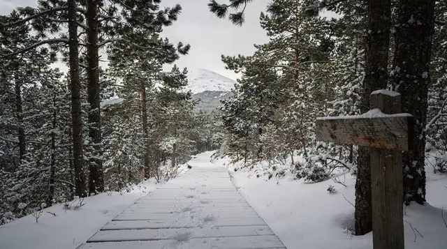
Winter is a different site altogether. The rapids don’t fully freeze — the current is too strong — so open water and steam rise from a landscape otherwise covered in snow, which is its own kind of striking. Access in winter usually means snowshoes or skis rather than boots, the visitor centre keeps shorter hours, and numbers drop to a handful of visitors a day rather than hundreds.
Where to photograph it
The main viewing platform above the rapids, a short walk from the suspension bridge, is the standard shot: rapids in the foreground, forested cliffs on the far bank, and enough elevation to show the scale of the white water. It’s also where everyone else stands, so expect to wait a turn at the rail in peak season, or to work around other visitors in your frame.
For something less generic, the suspension bridge itself photographs well both from a distance — a thin line strung across the gorge — and from the middle, looking down at the current directly beneath your feet. A short distance downstream from the main platform, quieter riverside spots open up where the crowd thins noticeably; these reward a slower approach rather than a five-minute stop.
Light matters more than angle here. Midday sun in July flattens the water and blows out highlights on the white spray; early morning or evening light rakes across the rapids at a lower angle and brings out texture in both the water and the rock. A polarising filter cuts glare off the wet surfaces and is worth packing if you’re bringing a proper camera rather than a phone. In winter, the contrast between dark open water, white snow banks and low, warm-toned sun produces some of the most striking versions of this scene, at the cost of a much colder wait for the right light.
Practicalities at the visitor centre
The Oulanka Visitor Centre has toilets, a small café serving coffee and simple food, an exhibition on the park’s geology and wildlife, and staff who can advise on trail conditions — genuinely useful in winter when ice and snow depth change week to week. There’s no entrance fee for the national park or for walking the Kiutaköngäs loop; Finland’s national parks are free to enter, in keeping with the country’s everyman’s right tradition of open access to nature. You pay only for food, parking is free, and any guided tour you book separately.
Mobile signal is generally reliable near the visitor centre and along most of the loop, though it can drop in the gorge itself. Bring water and a layer regardless of season — the gorge holds cooler air than the surrounding forest, and Finnish summer weather changes over the course of an afternoon more often than visitors expect.
Combining Kiutaköngäs with the rest of the day
Because the loop itself only takes a few hours, most visitors build it into something bigger. A common pattern from Rovaniemi is an early start, the Kiutaköngäs loop as the midday stop, then lunch and a couple of hours in Kuusamo or Ruka before the drive back — a full but manageable day covered in more detail in the Ruka and Kuusamo day trip guide.
If you’re staying in the Ruka area rather than doing the round trip in one day, Kiutaköngäs fits naturally into a slower two- or three-day stay that also takes in Oulanka National Park more broadly, summer hiking further along the Karhunkierros trail, and — outside the hiking season — the area’s downhill skiing at Ruka itself.
If you’re around Ruka in the evening after a day on the trails, the aurora season here runs on the same clock as Rovaniemi’s — dark, clear nights from late August through early April.
A guided evening walk out from Ruka to hunt the northern lights is a low-key way to end a hiking day without driving further, and for visitors who’d rather have a photographer along to handle camera settings, there’s a guaranteed northern lights tour with a photographer built around the same idea — “guaranteed” here means a repeat trip or refund if the sky doesn’t cooperate, not a promise about the aurora itself.
Families splitting the day between hiking and something gentler with dogs might prefer a short husky safari with lunch near Ruka rather than a second long walk.
If wildlife rather than water is the draw, the wider Kuusamo area is one of Finland’s better regions for brown bear watching and general wildlife watching in Lapland, both organised from hides well away from the main hiking trails.
What this page deliberately leaves out
Two things on purpose. First, this isn’t the place for a full breakdown of Oulanka National Park’s other trails, huts and permits — that’s the park guide. Second, and more important given how often the two get conflated: this is not a guide to walking the Karhunkierros trail end to end. Kiutaköngäs is a short, busy loop of a few kilometres that shares its starting section with one end of an 82 km wilderness route between Kuusamo and Salla.
Walking to the rapids and back over an afternoon tells you almost nothing about what multi-day Karhunkierros hiking involves — the wilderness huts, the river crossings further along, the self-sufficiency required away from the visitor centre. If the long trail is what you’re actually planning, start with the dedicated Karhunkierros guide rather than treating this page as a preview of it.
Kiutaköngäs rapids: your questions answered
How far is Kiutaköngäs from Rovaniemi?
Around 210–230 km by road, depending on the route and which park entrance you use, which works out to roughly 2h45–3h15 of driving. It’s a long way for a single short hike, which is why most visitors combine it with other stops around Ruka and Kuusamo rather than driving out and back for the rapids alone.
How long is the Kiutaköngäs loop trail?
The standard loop from the Oulanka Visitor Centre, including the suspension bridge and the main viewing platform, runs roughly 4–5 km. Walked at a relaxed pace with photo stops, that’s 1.5–2.5 hours; with time at the visitor centre and standing at the rapids, budget 2–4 hours for the full visit.
Is Kiutaköngäs the same as the Karhunkierros trail?
No. Kiutaköngäs is a short loop that shares its opening section with one end of the 82 km Karhunkierros trail, but walking to the rapids and back is not the same experience as hiking the full route, which involves multiple days, wilderness huts and considerably more remote terrain further from the road.
When is Kiutaköngäs least crowded?
Outside July and August, and within the day, before 10am or after 4pm even in peak summer. Late August and September combine cooler weather, the start of autumn colour, and a fraction of the coach traffic seen at the height of summer.
Do I need hiking boots for the Kiutaköngäs loop?
Not technically — the path is duckboards and packed gravel with a few short climbs — but shoes with decent grip are more comfortable than sandals, especially near the wet rock by the rapids and on the suspension bridge.
Is there an entrance fee for Oulanka National Park or Kiutaköngäs?
No. Finland’s national parks are free to enter under the country’s everyman’s right tradition. You only pay for food at the visitor centre café, or for any guided tour or transfer booked separately; parking at both the visitor centre and the Kiutaköngäs car park is free.
Can I visit Kiutaköngäs in winter?
Yes, though the experience changes considerably. The rapids stay open year-round because the current is too strong to freeze over, so you get steaming open water against snow-covered banks. Access typically means snowshoes rather than boots, visitor centre hours shorten, and crowds drop to a fraction of summer levels.
Is Kiutaköngäs worth the drive from Rovaniemi for just a few hours of walking?
On its own, it’s a long round trip for a short hike. It makes far more sense as one stop within a fuller day or overnight around Ruka and Kuusamo — paired with lunch, a longer stretch of the national park, or an evening aurora hunt — rather than as a dedicated there-and-back excursion from Rovaniemi.