Walking the Karhunkierros trail
Can you walk the Karhunkierros trail in a day?
Not the full trail. The Karhunkierros runs about 82km between Ruka and Hautajärvi through Oulanka National Park, and walking all of it takes most people four to six days with overnight stops at reservation huts or campsites. Several short sections near Juuma, including the loop over the Kiutaköngäs suspension bridges, are genuinely doable in a few hours.
The trail everyone’s heard of, and the version most people actually walk
The Karhunkierros, “the bear’s round”, is the best-known long-distance hiking trail in Finland: about 82km through Oulanka National Park, running between Ruka in the north and Hautajärvi in the south. It follows the Oulanka river for much of its length, crossing gorges and rapids on a string of wooden suspension bridges, the most photographed of which hangs over the Kiutaköngäs rapids.
Two things this page is not. It isn’t a general guide to summer walking around Rovaniemi — that’s covered separately, since most walking near the city is short and flat, nothing like this. And it isn’t about Ruka as a ski resort; Ruka’s downhill slopes and winter infrastructure are a different subject entirely. This page is specifically about the Karhunkierros trail itself, the full 82km version and the short sections that share its name and its bridges.
The practical point to get straight before anything else: walking the whole Karhunkierros is a multi-day undertaking that needs a hut reservation or a tent, not an afternoon out. Several short sections near the village of Juuma are genuinely a few hours’ walk. Conflating the two is the single most common mistake people make when planning this trip, so the rest of this guide keeps them separate throughout.
The full route: Ruka to Hautajärvi
The trail is usually walked from Ruka south to Hautajärvi, mostly because the terrain works slightly better in that direction, though both ways are signed and both are done regularly. Along the way it passes through Finnish Lapland terrain that shifts from pine forest to river gorge to open fell, with Kuusamo serving as the nearest town for supplies and transport at the northern end.
Most hikers cover the distance in four to six days, walking somewhere between 12 and 20km a day depending on fitness and how much time they spend at the bridges and viewpoints. It isn’t technical terrain — no ropes, no scrambling — but it is uneven, root-crossed, and often boarded over boggy ground, which slows progress more than the distance alone suggests. Weather on an open fell section can change quickly, and days with heavy rain make the duckboards slick.
Why this is not an afternoon walk
The full Karhunkierros requires you to sleep somewhere along the way, and Oulanka National Park’s overnight options fall into two categories. Reserved wilderness huts, varaustupa, are booked in advance through Metsähallitus’s national parks booking system; in July and August the popular ones fill up weeks ahead. Open wilderness huts, avotupa, and designated tent sites are first-come, first-served, with no guarantee of space on a busy night. Wild camping off the marked sites isn’t permitted inside the national park, which is a stricter rule than the general Everyman’s right: Finland’s nature access law explained that applies on ordinary Finnish land.
None of this is a reason to avoid the trail. It’s a reason to book huts before you go, carry a tent as backup if your dates aren’t fixed, and treat the 82km figure as a genuine multi-day trek rather than something to squeeze into a stopover. People do occasionally try to rush it in two long days; most who’ve done that describe it as more endurance test than hike.
Short sections you can actually do in a day
The good news is that you don’t need any of the above to see the trail’s best-known feature. Several access points let you walk a loop or an out-and-back section in a single visit, without a hut booking.
| Section | Distance | Typical time | Start point |
|---|---|---|---|
| Pieni Karhunkierros (Small Bear’s Trail) | ~12km loop | 3–5 hours | Juuma |
| Kiutaköngäs loop | ~4km | 1–1.5 hours | Kiutaköngäs car park |
| Myllykoski to Jyrävä | ~8km one way | 2.5–4 hours | Myllykoski |
| Taivalköngäs section | ~7km | 2–3 hours | Taivalköngäs |
The Pieni Karhunkierros is the one most day visitors walk: a loop from Juuma that crosses the Oulanka river twice on suspension bridges above the Kiutaköngäs rapids, with the option to cut it shorter at a couple of junctions if the weather turns. It shares bridges and scenery with the full trail without any of the logistics, which is exactly why it’s the section worth building a day around if you’re not committing to the whole route.
What the trail actually looks like
The reason the Karhunkierros has the reputation it does is the gorge scenery, not the fell tops — this isn’t an alpine trail. The Oulanka river has cut a series of narrow canyons through the bedrock, and the suspension bridges cross these at their most dramatic points, swaying gently underfoot with white water visible through the slats below.
Between the gorges, the walking is mostly quiet pine and spruce forest, occasionally opening onto low ridges with views back over the Oulanka National Park landscape. It’s a slower, more textured walk than the open fells further north around Riisitunturi National Park, and the two make a reasonable contrast if you’re spending several days in the area.
Wildlife sightings are possible but not something to plan around. The trail’s name comes from brown bears living in this part of eastern Finland, and while encounters on the path itself are rare, standard backcountry food storage at the huts is sensible rather than optional.
When to walk it
The Karhunkierros is a summer and early autumn trail. Snow generally clears from the route by June, and the trail stays walkable through to late September; by October, conditions deteriorate quickly. Late June through August is busiest, particularly around the huts; early September brings the first colours of the Ruska: Finnish Lapland’s autumn colour season season and noticeably thinner crowds, at the cost of shorter daylight for planning long days.
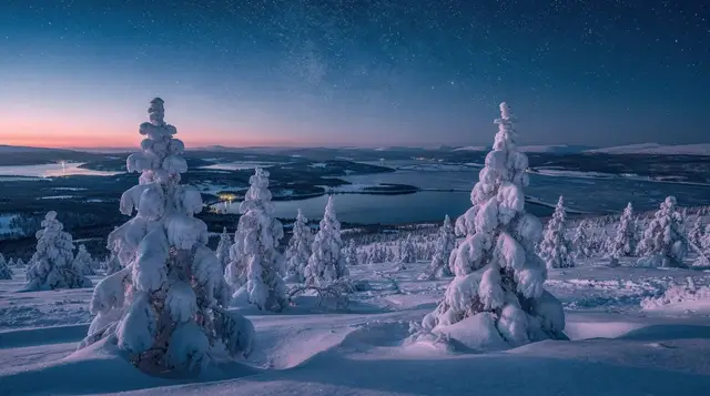
Outside the summer season the same ground is used differently. In winter, sections of the route become snowshoeing terrain rather than a hiking trail, with the bridges and gorges still the highlight but the pace and gear completely different.
a guided snowshoe walk along part of the Karhunkierros route covers this winter version for anyone visiting outside the hiking season, following the same river corridor on snowshoes rather than boots.
Getting to the trailheads
Both ends of the trail sit well outside Rovaniemi’s day-trip range. Ruka and Kuusamo are around 190km from Rovaniemi, close to two and a half hours’ drive, and there’s no direct public transport connection that makes this a simple day out without a car. Most visitors either base themselves in the Ruka-Kuusamo area for a few days, covered in more detail in Ruka and Kuusamo from Rovaniemi, or fold it into a longer Lapland road trip that already has Kuusamo on the route.
Inside the park, shuttle services and taxis run between the main trailheads in the busier summer months, useful if you’re walking a linear section rather than a loop and need to get back to your car. Checking current shuttle timetables before setting out saves a long road walk back to the start.
What to carry
For the short loops from Juuma or Kiutaköngäs, normal hiking gear and enough water for a few hours is plenty — see What to pack for Rovaniemi for the general approach to layering, which applies to summer hiking as much as winter cold. For the full trail, treat it as a genuine backcountry trip: a map (phone signal is patchy in the gorge sections), a stove or fuel if you’re not relying entirely on hut facilities, a sleeping bag rated for cool nights even in July, and a tent as backup in case a hut is full. Water from the river and side streams is generally treated as drinkable by hikers here, but a filter or purification tablets remove the guesswork.
a shorter guided outing into the park is a reasonable way to get a feel for the terrain and the gorges before committing to the full multi-day trail, particularly if you’re unsure how the distances and terrain will suit you.
Full trail versus short section, side by side
| Full Karhunkierros | Short section from Juuma | |
|---|---|---|
| Distance | ~82km | 4–12km |
| Time needed | 4–6 days | 2–5 hours |
| Accommodation | Hut booking or tent required | None needed |
| Suspension bridges | Several, spread along the route | Yes, at Kiutaköngäs |
| Fitness required | Multi-day trekking fitness | Moderate, ordinary hiking fitness |
| Best for | Dedicated hikers with time to plan | Anyone visiting the park for a day |
Other ways to see the park without the full trek
If the multi-day trail isn’t what you’re after but you want more of Oulanka than a single loop, the river itself is an option. Self-guided canoeing lets you cover a stretch of the Oulanka at your own pace — renting a canoe to paddle part of the river is a genuinely different way to see the gorges from water level. For something more active, a rafting trip through the park’s white water covers similar ground from the river rather than the bank, and needs no hut booking or multi-day planning either.
In summer, the fell above Ruka is also worth separating from the Karhunkierros proper: it’s a shorter, different walk, covered under the Hiking trails around Rovaniemi and Summer hiking around Rovaniemi and Finnish Lapland guides, alongside broader advice on choosing a trail that matches the time and gear you actually have. The Korouoma canyon canyon further west and the Snowshoeing near Rovaniemi options nearer the city are both reasonable alternatives if a 190km drive to Kuusamo doesn’t fit your itinerary.
The decision, plainly
If you have four to six days free, proper gear, and you book huts in advance, the full Karhunkierros is one of the more rewarding long hikes in Finland — genuinely varied terrain, real gorges, and none of the commercial gloss that surrounds some of the country’s other big attractions. If you don’t have that much time, the Pieni Karhunkierros loop from Juuma gives you the suspension bridges, the Kiutaköngäs rapids, and a real sense of the landscape in an afternoon. What doesn’t work is treating the full 82km as something to fit into a spare afternoon on a longer Lapland trip — that’s the version of this trail that leaves people either turning back early or finishing after dark with no booked bed.
Karhunkierros trail: your questions answered
How long is the Karhunkierros trail?
About 82km, walked most commonly between Ruka in the north and Hautajärvi in the south, through Oulanka National Park. Trail signage sometimes gives slightly different figures depending on which access spurs are counted.
Do I need to book anything to walk it?
For the full trail, yes. Overnight stays in the reserved huts (varaustupa) go through Metsähallitus’s online booking system and can fill up in July and August. Open wilderness huts (avotupa) and tent sites are first-come, first-served, but you should still plan where you’ll sleep before setting out.
What is the most popular short section?
The Pieni Karhunkierros, or Small Bear’s Trail, a roughly 12km loop from Juuma that crosses the Kiutaköngäs rapids on suspension bridges. It’s the section most day visitors walk, and it can be done in three to five hours without any hut booking.
Is the Karhunkierros suitable for beginners?
The short loops from Juuma are fine for anyone with basic fitness and proper footwear. The full 82km trail is a different proposition: multiple days of carrying gear over uneven, rooty, sometimes wet terrain, with limited resupply. It’s a hiking trail, not a technical route, but it isn’t a casual outing.
When is the trail open?
The trail is walkable roughly from June to late September, once the snow has cleared and before it returns. Outside that window, sections are used for winter activities like snowshoeing rather than summer hiking, and the huts and duckboards are harder to reach.
Where does the Karhunkierros start and finish?
The usual route runs from the Ruka side in the north to Hautajärvi in the south, following the Oulanka river through the national park. Many walkers go north to south because it’s marginally easier, but both directions are marked and used.
How far is Oulanka National Park from Rovaniemi?
Around 190km, roughly a two and a half hour drive. There’s no direct public transport link that makes this a simple day trip from Rovaniemi without a car or a booked tour.
Are there bears on the Karhunkierros?
The trail’s name translates as “the bear’s round”, and brown bears do live in this part of Finland, but sightings on the trail itself are uncommon. Guides recommend normal backcountry food storage rather than any special precaution.
Hiking & nature tours on GetYourGuide
Verified deep-linked GetYourGuide tours. Book through these links and we earn a small commission at no cost to you.
GetYourGuide does not provide a product photo for this activity — the image shows the meeting point, photographed by us.