Where Utsjoki sits, and why the drive matters
Utsjoki is the northernmost municipality in Finland, a long strip of land wrapped around the Teno river where it forms the border with Norway. It sits well beyond Inari, which most visitors already treat as the edge of the map. If Inari is the last town with a proper supermarket and a museum worth two hours, Utsjoki is what lies past that: fewer buildings, fewer people, and a landscape that is treeless fell and open river valley rather than the pine and birch forest around Rovaniemi.
This page covers Utsjoki village and the municipality’s character as a border and fishing destination. It does not repeat what belongs to Inari’s own page, and it does not cover Nuorgam in depth, even though Nuorgam is technically a village inside Utsjoki municipality and the actual northernmost point in Finland. Treat Utsjoki and Nuorgam as two separate stops on the same road, not one destination.
How far it really is, and why people underestimate it
This is the trap worth naming clearly: Utsjoki is not a day trip tacked onto an Inari visit, and it is considerably further than the map suggests once you are used to Lapland distances that top out around Saariselkä or Ivalo. From Rovaniemi it is roughly 480 to 500 km, which works out to 5.5 to 6.5 hours of driving in good conditions, more in winter darkness or poor weather. The road runs through Ivalo and Inari before continuing north along the Teno valley, and past Inari there is no motorway feel to it — it is a single road, often quiet, sometimes with reindeer standing on the tarmac.
| Leg | Approximate distance | Approximate driving time |
|---|---|---|
| Rovaniemi to Ivalo | 290 km | 3.5-4 hours |
| Ivalo to Inari | 40 km | 30-40 minutes |
| Inari to Utsjoki village | 115-120 km | 1.5-2 hours |
| Rovaniemi to Utsjoki (total) | 480-500 km | 5.5-6.5 hours |
There is no realistic way to see Utsjoki and get back to Rovaniemi the same day. Anyone weighing it as a day trip from Rovaniemi should read what actually counts as a day trip from Rovaniemi first — Utsjoki sits firmly on the wrong side of that line. The sensible way to see it is as an overnight extension of a longer loop through Saariselkä and Inari, covered in the Saariselkä and Inari day trip guide and the eastern Lapland Sámi culture itinerary.
There is no train and no scheduled flight to Utsjoki. A car is close to essential; long-distance buses exist but run on thin, infrequent schedules that do not suit a short visit. Anyone renting a car for this stretch should also read the practical notes on winter tyres and rental terms — reindeer crossings are a real hazard on this road, not a tourist-brochure warning.
The Teno river and its salmon — a regulated season, not a year-round draw
The Teno (Tana in Norwegian) is the reason Utsjoki has any profile at all outside Finland. It is one of Europe’s most productive wild Atlantic salmon rivers, running along the Finland-Norway border before continuing into Norway and reaching the sea at the Tanafjord. Anglers have travelled here for generations for salmon that can run well over 10 kg.
What surprises first-time visitors is how tightly this is controlled. Salmon fishing on the Teno is managed jointly by Finland and Norway under a bilateral agreement, with a defined open season in summer, licensing requirements, and catch reporting. Outside that season the river is closed to salmon fishing. This is not a river you turn up to with a rod in October and expect to fish; the regulations exist because stocks have been under real pressure, and enforcement is active on both banks. If fishing is the actual reason for the trip, sort out permits and season dates directly with the official Finnish and Norwegian fisheries authorities before travelling, not on arrival.
Outside the salmon season, the river is still worth seeing — the valley it carves is the most striking landscape in the municipality, wide and treeless with the fells rising on either side. A calmer way to experience it without a rod is a slow pass on the water itself: a private traditional riverboat cruise on the Teno covers the same stretch of river at a pace that has nothing to do with fishing quotas.
Sámi Utsjoki
Utsjoki is the only municipality in Finland where Sámi speakers form a majority of the population, and it sits inside the Sámi homeland alongside Inari, Enontekiö and part of Sodankylä. This is not a staged “Sámi village” of the kind that exists around Rovaniemi — it is where a real Sámi-majority community lives, works reindeer herding cooperatives, and speaks North Sámi day to day alongside Finnish.
That distinction matters for how to visit responsibly. There is no equivalent here of the Siida museum in Inari, which remains the best-curated introduction to Sámi history and culture in the region and is worth visiting on the way north rather than skipped. What Utsjoki offers instead is the chance to see Sámi life as an ongoing, working reality rather than a museum exhibit — reindeer earmarks on fences, place names in North Sámi on road signs, and a landscape still organised around herding rather than tourism.
For background before arriving, the general explainer on Sámi culture is a better starting point than anything printed on a souvenir shop wall, and it is worth reading what to avoid buying, since imitation “Sámi” costumes and trinkets sold as novelty items are a genuine point of friction with these communities, not a harmless souvenir.
A small, low-key way to meet this working side of the region rather than a performance of it is a visit to a reindeer farm run by a local family, where the animals are part of an actual livelihood rather than a photo prop.
What is actually in Utsjoki village
Set expectations before arriving: Utsjoki village is small. It has a church, a health centre, a fuel station, a handful of shops and a bank branch of sorts, and that is close to the full list. It functions as the administrative and service centre for a municipality roughly the size of a small European country by area, with a population in the low thousands spread across it. This is not a resort, and it was never built to be one. There is no equivalent of Rovaniemi’s Santa-themed retail strip, no strip of restaurants to choose between, and grocery choice is limited compared with even Inari, let alone Rovaniemi — stock up before leaving Inari if you have specific needs.
What the village does have is a genuine end-of-the-road feel and river views that most of Lapland’s more developed spots have lost to buildings and car parks. The bridge across the Teno at the village is a natural point to stop, look across the water into Norway, and register that you have reached a border most visitors to Finland never see.
The fells and the empty land around it
The terrain around Utsjoki is fell country — open, low vegetation, wide sightlines, and a silence that is different from the forested feel further south. Hiking here is not about summiting anything dramatic; it is about walking into genuinely empty land with the Teno valley as a reference point. Under Finland’s everyman’s right, walking and short-term camping across most of this open country requires no permission, provided you keep your distance from homes and herding activity — the same rule explained in the guide to nature access rights applies here as anywhere else in Lapland.
For a guided route rather than heading out alone into unfamiliar terrain, a guided hike to the nearby fells is the straightforward option, and a gentler version exists too for anyone who wants the landscape without a demanding walk. In winter, the same ground opens up for snowshoeing rather than hiking; snowshoeing across the tundra covers similar terrain once the ground is under snow.
Anyone drawn to this kind of remote fell and river landscape but not committed to the full drive to Utsjoki should also weigh Urho Kekkonen National Park and Lemmenjoki National Park, both closer to Saariselkä and Inari and offering a comparable sense of scale with a shorter drive.
Crossing into Norway
Utsjoki municipality sits directly against the Norwegian border, and the crossing is unremarkable in the way most Schengen land borders are: no checkpoint, no stamps, just a sign and a change of road markings. There are crossing points near Nuorgam, further north along the Teno, and further south at Karigasniemi, which connects to Karasjok on the Norwegian side. Neither side of the border offers dense infrastructure — fuel and food remain sparse in the Norwegian towns just across the line too, so this is not a shortcut to better facilities, simply a different country with its own currency (Norwegian krone, not euro) and its own driving rules.
Anyone genuinely continuing into Norway from here — toward Tana Bru and the coast, or further to Nordkapp — should treat that as a separate, multi-day trip rather than an extension of a Rovaniemi holiday. Nordkapp itself sits roughly 300 km beyond the border crossing, another half-day of driving on top of everything already covered getting to Utsjoki.
Northern lights and seasons
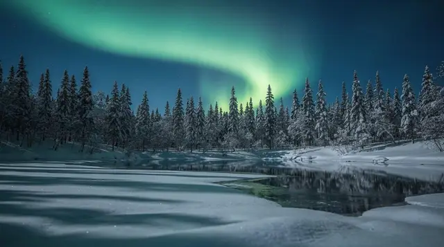
Utsjoki lies well north of the Arctic Circle, and by the numbers its aurora season and dark-sky window are at least as good as Rovaniemi’s — the same late-August-to-early-April season applies, and the same rule holds: activity, clear sky and darkness all have to align, and nothing is guaranteed regardless of what a tour is marketed as. What is different here is the backup situation.
In Rovaniemi, a cloudy night sends a minibus 100 km in any direction to find a gap in the weather; in Utsjoki, options are far more limited simply because there is less road network and fewer operators to call on. A structured evening built around this reality, using a traditional lavvu shelter and a fire as the base while watching for a break in the cloud, is the realistic way to try for it here: a northern lights evening at a lavvu.
Midsummer brings the opposite extreme — the sun does not set for weeks this far north, which is part of what makes the open, treeless fell landscape feel different from anywhere further south. Late August into September brings the ruska colour change across the tundra vegetation, arriving here slightly earlier than in Rovaniemi given the latitude, and it doubles as the start of dark-enough nights for the first aurora sightings of the season.
Getting there and getting around
There is one practical route: drive north from Rovaniemi via Ivalo and Inari on the E75/road 4, then continue on road 970 into Utsjoki. Fuel up in Inari — stations are far apart past that point, and running low on fuel on this stretch is a genuine risk rather than an inconvenience. Mobile coverage thins out in places but is generally present along the main road; do not assume the same away from it. Winter driving here means committing to a long stretch of road in darkness or low light with reindeer and, occasionally, wandering domestic dogs on the tarmac — see the notes on driving conditions and reindeer before setting out, and budget more time than the raw distance suggests.
Accommodation in Utsjoki village is limited to a small number of guesthouses and cabins rather than hotel chains; book ahead, particularly around the open salmon season when anglers fill what capacity exists. Card payment is standard even in small shops, as everywhere in Finland, but do not assume every fishing-permit office or small operator takes cards — carrying some cash is a reasonable precaution this far from the nearest large town.
Practical facts at a glance
| Practicality | Situation in Utsjoki |
|---|---|
| Currency | Euro; cards accepted almost everywhere, some cash useful for small permit offices |
| Fuel | Limited stations; fill up in Inari before continuing |
| Mobile signal | Generally present on the main road, patchy off it |
| Accommodation | Small guesthouses and cabins; book ahead for salmon season |
| Public transport | Infrequent long-distance buses; no train or scheduled flight |
| Border crossing | No checks into Norway (Schengen); Norwegian krone used across the line |
Frequently asked questions about visiting Utsjoki
How far is Utsjoki from Rovaniemi?
About 480-500 km, roughly 5.5 to 6.5 hours of driving, via Ivalo and Inari. There is no direct flight or train; it is road only, and long-distance buses run infrequently.
Can I fish for salmon on the Teno at any time of year?
No. Salmon fishing on the Teno is governed by a Finland-Norway agreement, runs on a defined summer season, and requires a permit bought in advance. Outside that window the river is closed to salmon fishing.
Is Utsjoki the same place as Nuorgam?
No. Nuorgam, Finland’s actual northernmost point, is a village within Utsjoki municipality, further along the same road. Utsjoki village, on the Teno, is the municipal centre and a distinct stop in its own right.
What is actually in Utsjoki village?
A small centre with a church, a health centre, a fuel station and a handful of shops. It functions as the service point for a vast, sparsely populated municipality, not as a resort.
Is it easy to cross into Norway from Utsjoki?
Yes. Road crossings near Nuorgam and further south at Karigasniemi involve no border checks inside the Schengen area, though facilities remain sparse on both sides of the line.
Do I need a car to visit Utsjoki?
In practice, yes. Public transport is infrequent and does not reach most of the area’s actual attractions, including the river and the fells around the village.
Are the northern lights good in Utsjoki?
The season and darkness are at least as favourable as Rovaniemi’s, since Utsjoki lies well north of the Arctic Circle. The trade-off is isolation: fewer tour operators and fewer backup options if the sky clouds over.